Teerosen: hidden drawings in the land
2014
Stichting Verborgen Landschap invited artists to do research on the unknown qualities of the military landscape around former airbase ‘Deelen’. I chose to explore this landscape to hunt traces of the Teerosen installations.
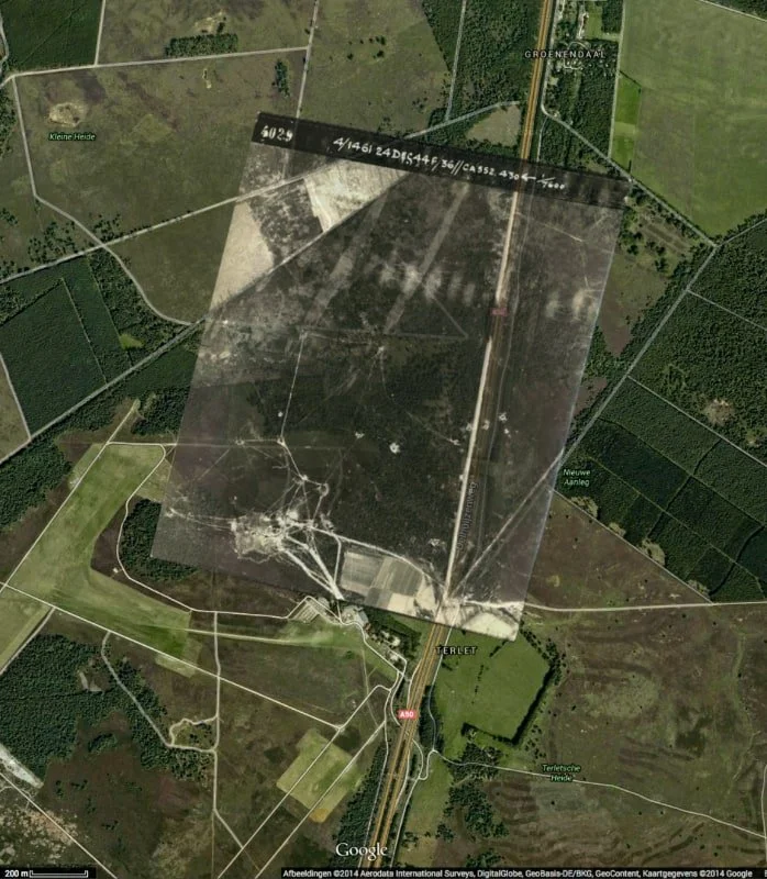
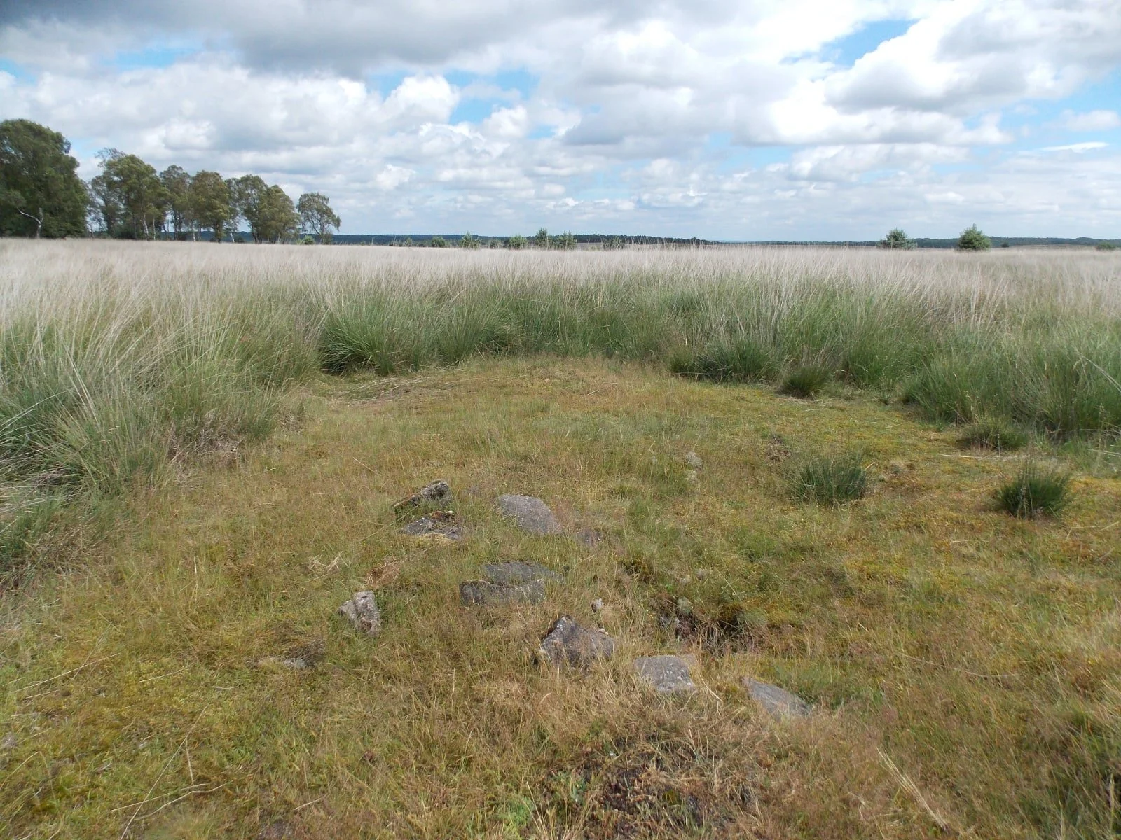
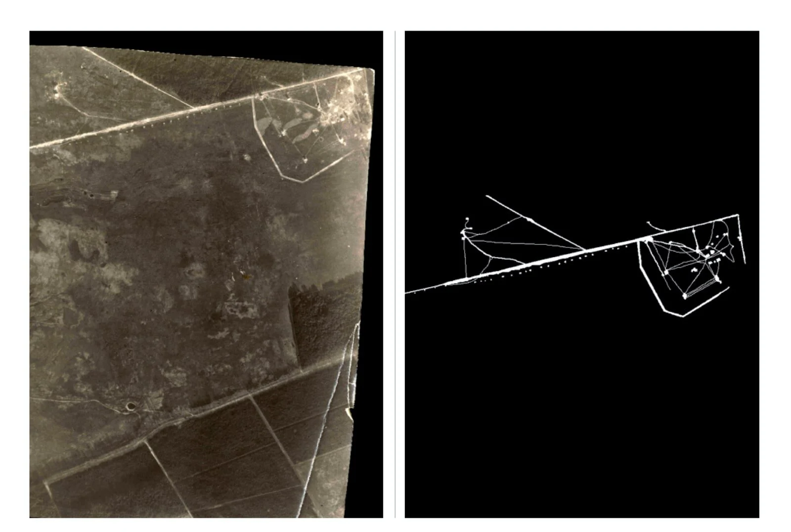
The ‘Teerosen’ were three installations of radio- and radar towers built by the Germans during WW-II for monitoring the air and communication with their pilots. The buildings were camouflaged so they would be invisible from the air. However, by walking between the buildings, white sand came up and the white lines gave away these strategic targets. The Teerosen were bombed and the remnants disappeared into the soil.
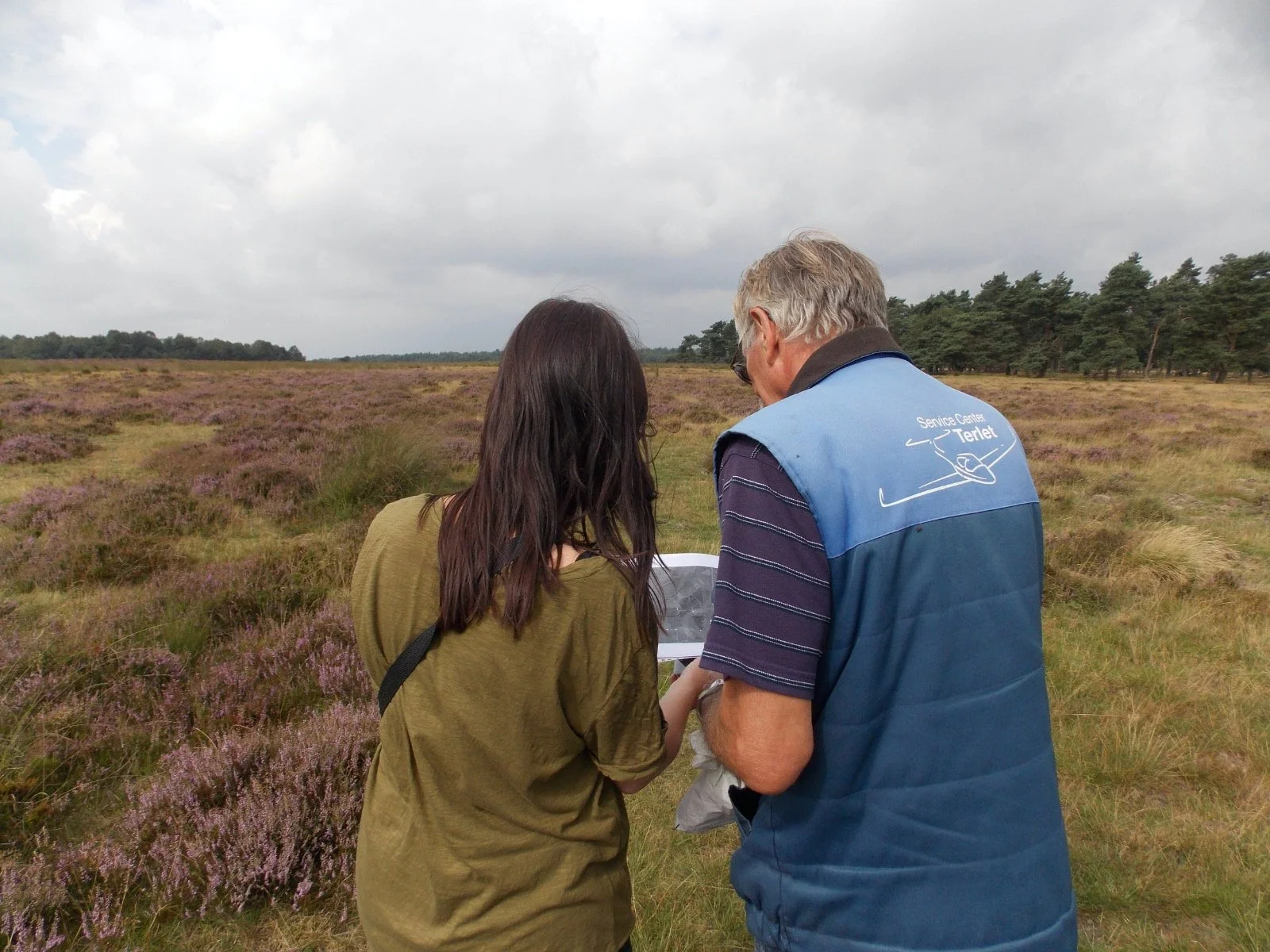
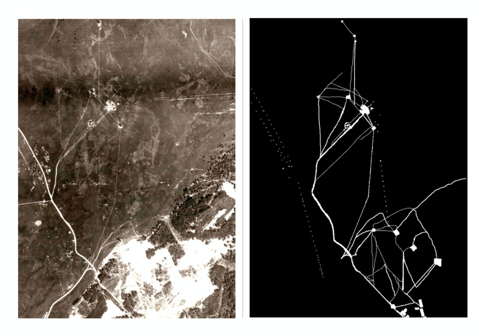
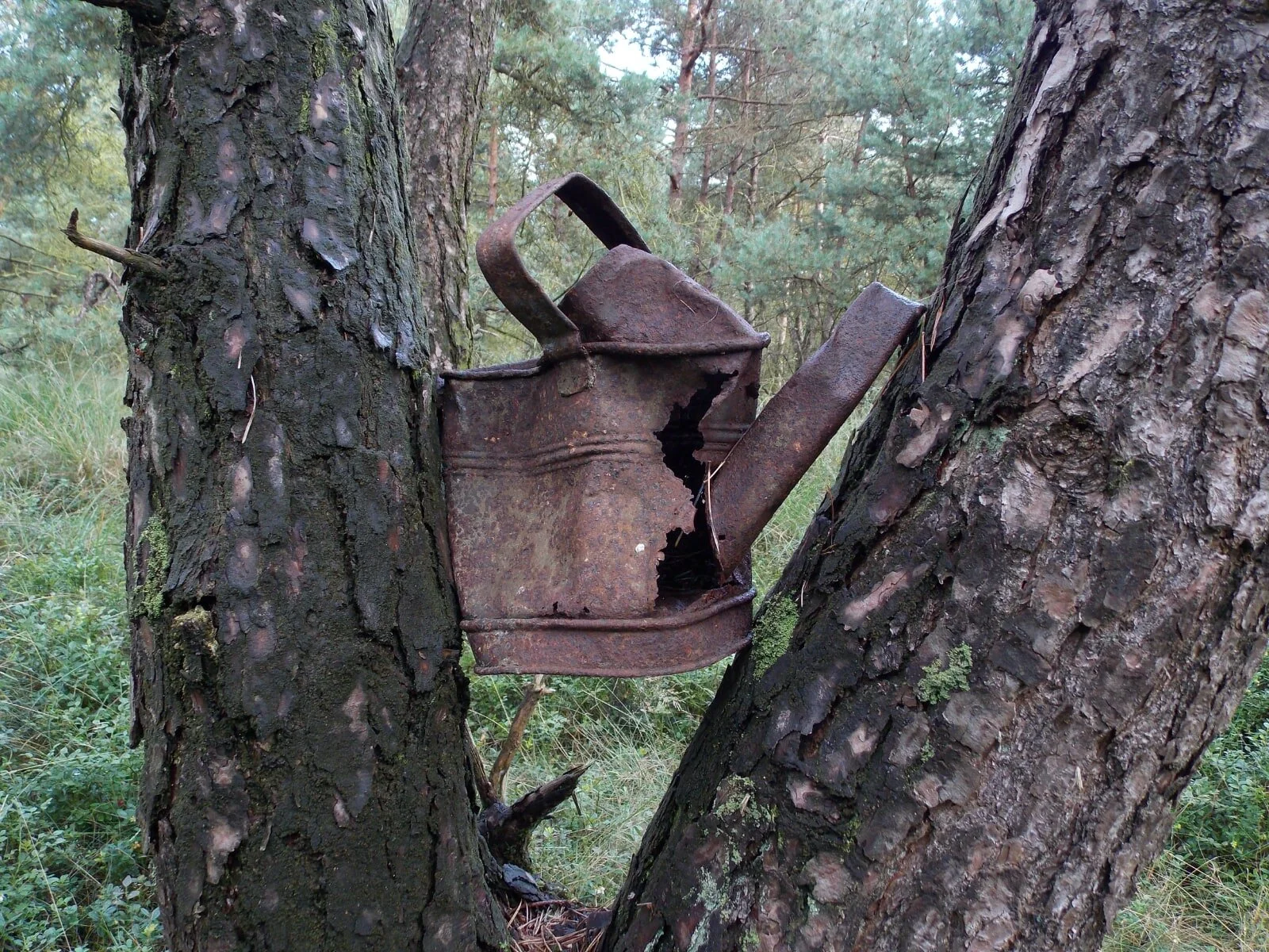
When I saw these white lines on RAF aerial photographs, I decided to perform an exact walk over every line, to see what today would be left of the Teerosen. Combining the old RAF images with modern Google maps, I created my own maps and I documented everything I found walking these lines. The walk and its documentation expose the disappearance of these war installations, as they are swallowed by nature, built over by new buildings, stolen or removed otherwise.
The research was published in a cahier and a book and used for further research by archaeologists. Also Natuurmonumenten used the research for walking excursions.