Guide Lines
2022
Woenst & Bijster, Bennekom

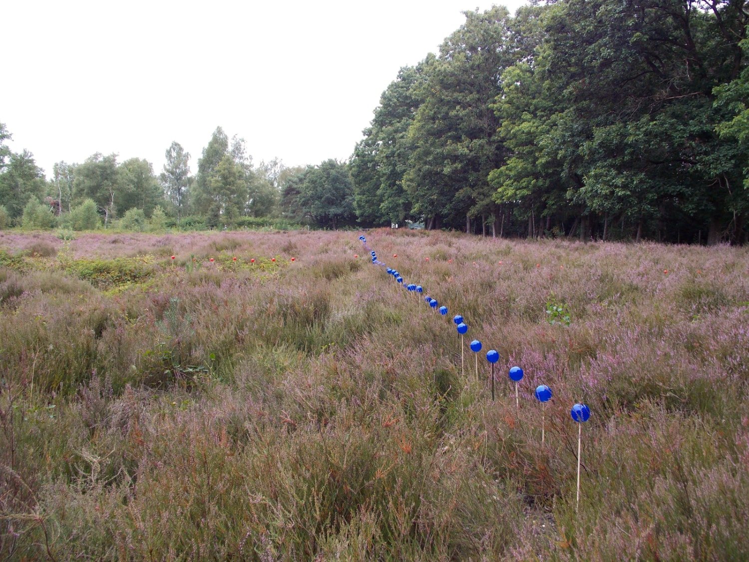
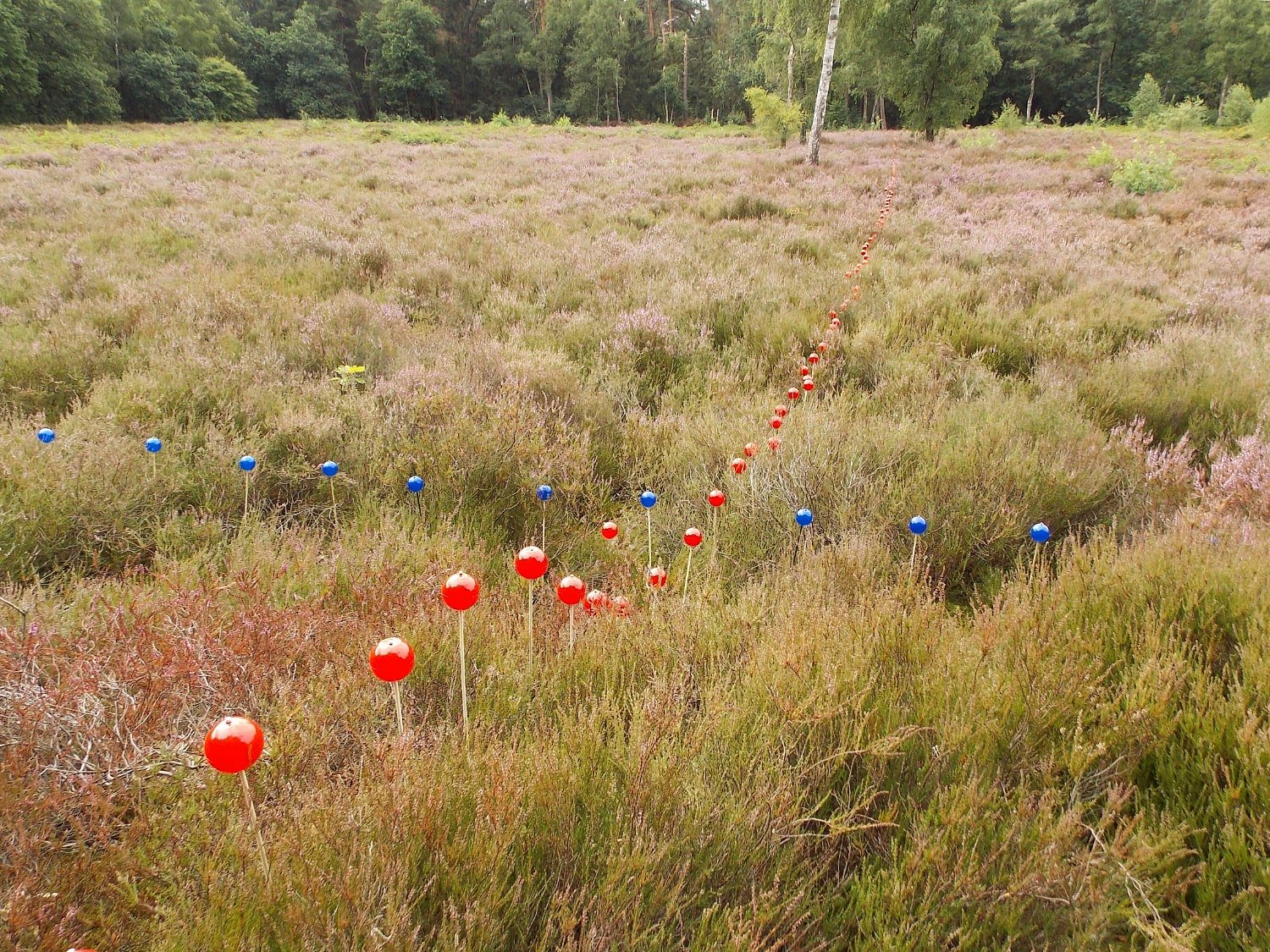
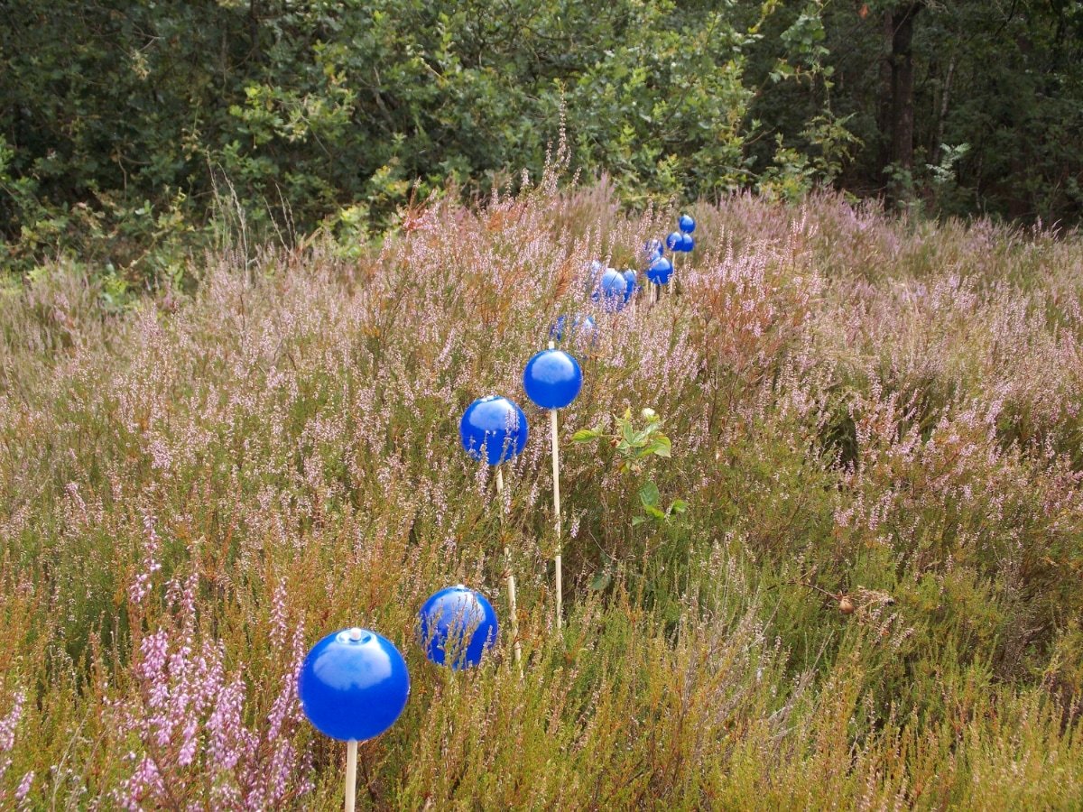
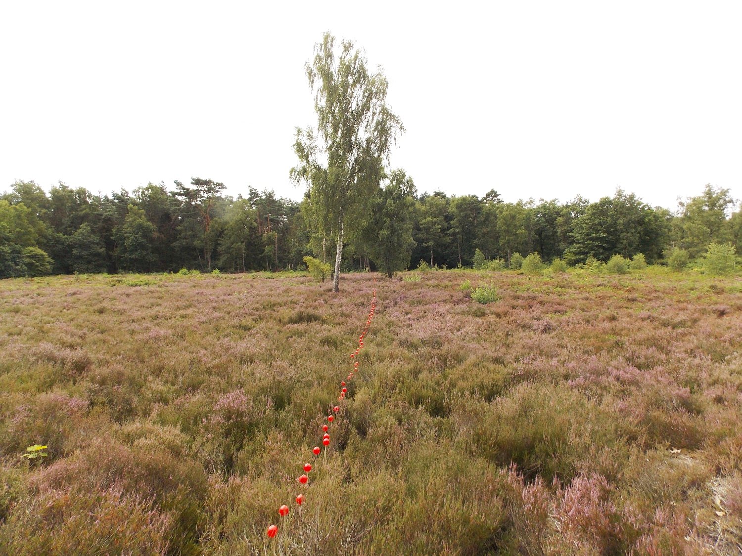


Stichting Woest&Bijster zet zich in om het landschap van de Zuid-Veluwe onder de aandacht te brengen met locatiekunst en locatietheatervoorstellingen. In 2022 werd ik uitgenodigd om een locatiewerk te maken op een veld waar onder het oppervlak archeologisch een Celtic Field is geïdentificeerd. Celtic Fields waren rechthoekige velden die rond 200 v. Chr. door boeren werden aangelegd. Deze velden werden van elkaar gescheiden door aarden wallen, die als lijnen door het landschap liepen.
Op het eerste gezicht lijken de Celtic Fields aan de Panoramaweg in Bennekom een gewone, lege heide. Er staat een uitkijktoren, die er ooit is gebouwd zodat mensen de resten van de Celtic Fields kunnen bekijken. Verondersteld wordt dat deze resten nog als lijnen in het veld zichtbaar zijn, maar dat is in werkelijkheid niet het geval. Ze kunnen echter wel worden gedetecteerd met behulp van laser-altimetrie vanuit de lucht: een laserscanmethode die van bovenaf wordt uitgevoerd met behulp van een klein vliegtuigje of drone. Ik werkte samen met een lokale archeoloog om de kaarten die door deze laseraltimetrie zijn geproduceerd te analyseren en de tekeningen die in de bodem verborgen zitten te bestuderen. Mijn doel was om deze verborgen tekeningen tijdelijk en subtiel zichtbaar te maken vanaf de bestaande uitkijktoren. Dit bleek een hele uitdaging, omdat deze site niet alleen op de lijst van beschermde archeologische monumenten staat, maar ook de natuur beschermd is en de bodem vermoedelijk nog niet-gesprongen explosieven uit de tweede wereldoorlog bevat.
The Woest&Bijster Foundation is committed to drawing attention to the landscape of the South Veluwe through site-specific art and location theatre performances. In 2022 they invited me to create a site-specific work on a field where underneath the surface, a Celtic Field is archaeologically identified. Celtic Fields were rectangular fields that were created by farmers around 200 B.C. These fields were separated from each other by earthen walls, which ran through the landscape like lines.
At first glance, the Celtic Fields on the Panoramaweg in Bennekom look like an ordinary, empty heathland. There is a watchtower, which was once built there so that people can view the remains of the Celtic Fields. These remains are presumed to be still be visible as lines in the field, but are actually not. However, it can be detected by airborne laser altimetry: a laser scanning method conducted from above the surface using a small airplane or drone. I collaborated with a local archaeologist to analyse the maps that were produced by this laser altimetry and to study the drawings hidden in the soil. My aim was to make these hidden drawings temporary and subtly visible from the existing watchtower. This appeared to be very challenging due to the fact that this site is not only listed as a protected archeological monument, also its nature is protected and the soil is suspected to contain explosives from the second world war.
Guide Lines
2022
Temporary installation for Woest & Bijster
150 x 170 x 0,50 m
PVC balls and wooden sticks (PVC balls were recycled)
Map by: ADC ArcheoProjecten Amersfoort, rapport 3880, J. Huizer, A.E. Botman & R.R. Datema.
With many thanks to: Carmen Harmsen, policy advisor archaeology in Ede + Volunteers of Woest & Bijster.